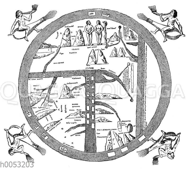
Mittelalterliche Erd-Karte: Zeichnung/Illustration/Holzstich – – Medieval Earth Map. According to a manuscript supposedly from the 12th century at the library in Turin – Carte médiévale. de la terre. Selon un manuscrit supposé du 12ème siècle dans la bibliothèque de Turin
Bildnr.: h0053203
Bildtyp: Holzstich
Urheber:
Ausgelieferte Bildgröße: 6.521 x 5.861 Pixel, vgl. dazu unseren Pixelrechner
Dateigröße als jpg: 15.7 MB
Erscheinungsdatum: 1902
Map of the earth; Middle Ages; World Map; medieval; Geography; Weltanschauung; Worldview; Wind; winds; four winds, carte de la terre; Moyen Age; Carte du monde; médiévale; la géographie; la géographie; Weltanschauung; Worldview; le vent; vents; quatre vents
Serie:
![Kreisförmige Ornamente [Digital]](https://www.quagga-illustrations.de/wp-content/uploads/2014/03/h0014456-300x467.jpg)
![Burg Steinsberg, mittelalterliche Burganlage [Digital]](https://www.quagga-illustrations.de/wp-content/uploads/2014/03/h0015450-300x293.jpg)
![Mittelalterlicher Klappstuhl aus Bronze. 12. Jahrhundert. (Viollet-le-Duc) [Digital]](https://www.quagga-illustrations.de/wp-content/uploads/2014/03/h0014543-300x349.jpg)